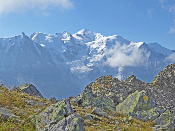
Enjoy amazing, nonstop views of Mount Blanc range on the strenuous loop hike climbing along the upper and middle slopes of the Aiguilles Rouges. The hike includes a stop at Lac Blanc, offering unparalleled views of the range.
See Trail Detail/Full Description
- Distance: 11.0 miles (loop) to Loop
- Elevation: 6,600-ft. at Trailhead
8,120-ft. at Loop - Elevation Gain: 3,200-ft. to Loop
- Difficulty: strenuous
- More Hikes in:
Chamonix / French Alps
Why Hike Aiguilles Rouges Loop
From start to finish this hike is packed with breathtaking views of the Mont Blanc Range. Starting from Planpraz, high above Chamonix, the initial segment of the loop climbs through rugged terrain along the upper slopes of the Aiguille Rouges and offers options to visit two small lakes cradled in rocky basins near the ridge line. The segment ends at Lac Blanc, one of the quintessential overlooks in Chamonix area. On a clear day the high peaks between Mont Blanc and Aiguille Verte are mirrored in the lake’s waters.
After enjoying Lac Blanc, we descend on an easier trail to La Flegere where we join the Tour du Mont Blanc (TMB) trail, also known as the Grand Balcon Sud (Grand South Balcony). This segment of the TMB follows an undulating path along the Aiguille Rouges mid-level slopes back to Planpraz. Along the way enjoy panoramic views of the Mont Blanc massif and the Chamonix Valley.
The hike starts with a ride up the Planpraz-Le Brevent gondola to the middle station at Planpraz. Taking the lift eliminates a steep 3,166-ft. climb from Chamonix.
The hike can be shortened by using the lift at La Flegere that descends to Les Praz de Chamonix. For an easier day, simply walk from Planpraz to La Flegere (or vice-versa).
Please be aware that snow can linger into August on the upper segment of the loop. Check on local conditions at the Chamonix Tourist Office before setting out. A short segment of the first leg of the loop travels along a route that requires some minor scrambling. There are also segments of the upper trail with minor exposure that I don’t recommend for anyone with a fear of heights.
Be sure to pick a day full of promise and get an early start to enjoy this fabulous hike. The views, some rugged terrain and optional side trips will make the trip take longer than implied by the mileage.
Elevation Profile

Trail Resources
Trail Detail/Full Description / Trail Photo Gallery / Trail Map
Basecamp(s) Information:
Chamonix
Region Information:
French Alps
Other Hiking Regions in:
France
