Fire Brand Pass 
Distance: 10.2 miles (round trip)
Glacier National Park, near Two Medicine in Glacier Natl Park, MT
Lovely, lightly trafficked trail ascends to a high pass in the southern section of Glacier National Park with fine views of the peaks rising above the Railroad Creek and Ole Creek Valleys. In season the meadows along the trail are awash in wildflowers.
See Trail Detail/Full Description
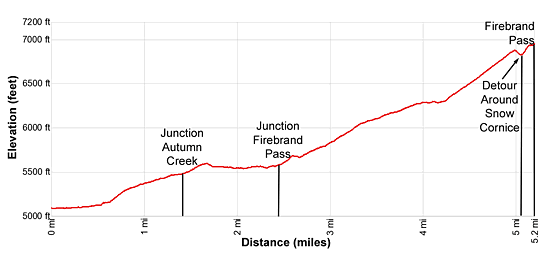
- Distance: 10.2 miles (round trip) to Firebrand Pass
- Elevation: 5,090-ft. at Trailhead
6,951-ft. at Firebrand Pass - Elevation Gain: 1,861-ft. to Firebrand Pass
- Difficulty: moderate-strenuous
- More Hikes in:
Two Medicine / Lake McDonald / Glacier Natl Park, MT
Why Hike Fire Brand Pass
Few hikers visit the trails in the southern section of Glacier National Park. Those that do will appreciate a wilderness experience with a level of solitude not found along the park’s more popular trails. Firebrand Pass is my favorite trail in the area. Starting to the east of Marias Pass along U.S. Highway 2, the trail loops around Calf Robe Mountain’s north ridge and then ascends to a scenic pass between Calf Robe and Red Crow Mountains.
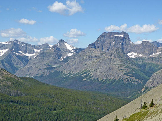
The trail enjoys good views of the peaks punctuating the ridge paralleling U.S. Highway 2 and the summits rimming the Railroad Creek Valley. From the pass fine views unfold to the distinctive peaks towering above the upper Ole Creek Valley. Lovely meadows fills with wildflowers in the season add interest to the hike.
The last time I hiked the trail we ran into one other party and had the pass to ourselves. The pass was named after a fire that swept over the area in 1910. That year wildfires torched more than 100,000-acres in the newly formed park. Sitting atop the pass one can only image the devastation caused by the fires but also marvel at nature’s power of renewal.
Note: This is grizzly bear country. Carry bear spray and make plenty of noise as you pass through the thick vegetation along sections of this trail.
Elevation Profile

Trail Resources
Trail Detail/Full Description / Trail Photo Gallery / Trail Map
Basecamp(s) Information:
Two Medicine / Lake McDonald
Region Information:
Glacier Natl Park, MT
Other Hiking Regions in:
Montana
