The Garden Wall 
Distance: 4.0 - 11.6 miles (loop)
Glacier National Park, near St Mary in Glacier Natl Park, MT
The Garden Wall / Highline trail is one of my favorite hikes in the park. The moderate / moderately-easy trail traversing the western flanks of the Continental Divide features panoramic views of the Livingston and Lewis Ranges along with excellent wildlife viewing opportunities.
See Trail Detail/Full Description
- Distance: 11.6 miles (loop) to Garden Wall
- Elevation: 6,646-ft. at Trailhead
7,330-ft. at Garden Wall - Elevation Gain: 684-ft. to Garden Wall
- Difficulty: moderate
- More Hikes in:
St Mary / Lake McDonald / Glacier Natl Park, MT
Why Hike The Garden Wall
Stunning views of the Livingston and Lewis Ranges, amazing wildflower displays and an excellent opportunity to see wildlife are the hallmarks of this popular hike traversing the steep slopes beneath the Garden Wall on the Continental Divide. You do not need to do the entire loop to enjoy the views. Simply walk out as far as time and energy permit.
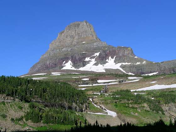
The trail and the views start at the Logan Pass Visitor Center (6,646-ft.) on the Continental Divide. At the pass enjoy fine views of Reynolds Mountain (9,125-ft.) to the south, Clements Mountain (8,760-ft.) and Oberlin Mountain (8,180-ft.) to the west and Pollack Mountain (9,190-ft.) to the northeast.
From the trailhead, located across the road to the north of the visitor center, the trail heads north along the western flanks of the Divide, staying for the most part above the timberline. Along the way the trail passes beneath the rugged peaks of Pollack Mountain, the Bishops Cap (9,127-ft.) and Mount Gould (9,553-ft.), connected by a series of serrated ridges. Progress will be slow as you stop often to take in the jaw-dropping views.
This section of the Divide is aptly known as the Garden Wall. Small streams and melt water cascading down the sheer slopes above the trail support a profusion of wildflowers growing amid the cliffs, rock piles and alpine meadows along the trail. Mountain goats and big horn sheep are often seen climbing the cliffs above the trail and grazing in the alpine meadows around the trail. Marmots and pikes scurry around boulder fields and rockslides. Occasionally bears are sighted grazing along the open slopes.
At 7.6 miles the trail reaches the Granite Park Chalet where a network of trails offers hikers and backpacks an array of options. Day hikers typically head down the Granite Park trail, which drops 2,000-ft. to the Loop, a hairpin curve on the Going-to-the-Sun Road. The trail travels through forest, meadows and a burn area devastated by the Trapper Creek Fire of 2003. At the Loop hikers can catch a shuttle bus back to Logan Pass or the Apgar Visitor Center on the west side of the park.
Lucky parties with overnight reservations at the Chalet or nearby campground can continue north along the Highline trail to Fifty Mountain campground and beyond. Other options include a hike up to Swiftcurrent Pass and the fire lookout atop Swiftcurrent Mountain. One popular option is to overnight at the Chalet or campground and the next day head over Swiftcurrent Pass, descending to the Swiftcurrent Valley to Many Glacier.
Be forewarned that the weather along the Highline can change quickly. Be sure to carry warm clothing and rain gear.
This is an extremely popular route and the initial section of the trail near Logan Pass can get quite crowded. As you walk further along the trail the crowds abate. Do not let the trail’s popularity deter you. Pick a day full of promise and get an early start. Whether you walk a few miles or do the entire loop you will not be disappointed.
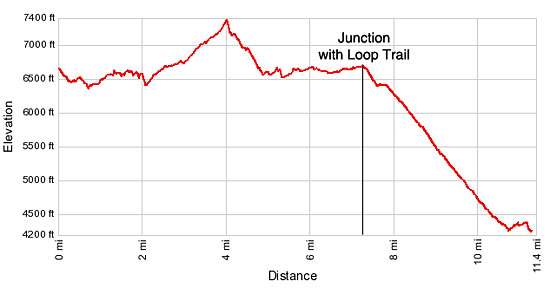
Elevation Profile

Trail Resources
Trail Detail/Full Description / Trail Photo Gallery / Trail Map
Basecamp(s) Information:
St Mary / Lake McDonald
Region Information:
Glacier Natl Park, MT
Other Hiking Regions in:
Montana
